Arkansas is a paradise for hiking enthusiasts, it goes without saying. The state offers outdoor adventurers with its array of stunning trails. There are so many options you can take a look at, which can make the choice quite complex.
Today, we want to provide you with a guide that explores the best hiking trails in Arkansas for 2023.
Without further ado, let us begin.
11. Whitaker Point Trail (Hawksbill Crag)
- Location: Ozark National Forest, Pettigrew, Arkansas
- Mileage: 2.7 miles (4.3 km)
- Main features: Iconic bluff views, waterfalls
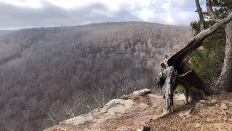
The Whitaker Point Trail, also known as Hawksbill Crag, is a jewel in the Ozark National Forest. This 2.7-mile trail leads hikers through a breathtaking journey to one of Arkansas’s most photographed locations. The trail is moderately challenging, making it accessible to a wide range of hikers.
As you walk, you’re surrounded by the lush greenery of the Ozarks, with occasional openings that offer glimpses of the valley below. The climax of the hike is the Hawksbill Crag, a rocky outcrop that juts out over the valley, providing a perfect backdrop for stunning photographs.
This spot gained fame after being featured in the Disney film “Tuck Everlasting,” adding a touch of whimsy to its natural beauty. Along the way, hikers can also enjoy the sight of small waterfalls, especially after rain, adding to the trail’s charm.
10. Lost Valley Trail
- Location: Ponca, Arkansas
- Mileage: 2.3 miles (3.7 km)
- Main features: Clark Creek, Eden Falls, Cobb Cave
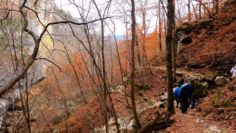
Lost Valley Trail, nestled in the Buffalo National River area, offers a 2.3-mile round trip that is as enchanting as it is diverse. The trail is moderately challenging, with some stairs and rocky surfaces, but it’s well worth the effort. As you follow the path, you’ll be walking alongside the serene Clark Creek, which adds a soothing soundtrack to your hike.
The trail’s main attractions include Eden Falls and Cobb Cave. Eden Falls cascades beautifully, especially during the wetter months, and is a sight to behold. Cobb Cave, a large shelter bluff, presents an opportunity to explore and imagine the lives of early inhabitants.
The natural bridges along the trail add an element of awe, making this hike a journey through both natural beauty and historical wonder.
9. Centerpoint to Goat Trail
- Location: Ponca, Arkansas
- Mileage: 5.9 miles (9.4 km)
- Main features: Big Bluff, stunning views of Buffalo River Valley
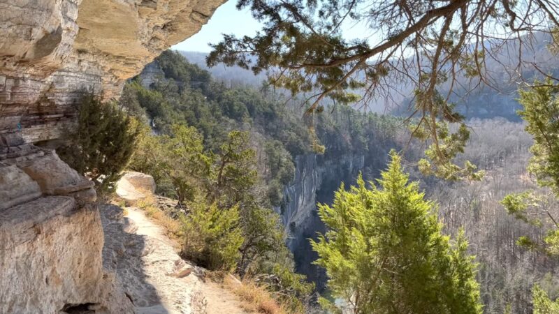
Centerpoint to Goat Trail is a must-visit for anyone seeking some of the best views in Arkansas. This 5.9-mile out-and-back trail is moderately challenging and is known for leading to the Big Bluff, a towering 550-foot cliff overlooking the Buffalo River Valley.
The trail is popular, so early arrival is recommended to secure parking. As you hike, the scenery of the Ozarks surrounds you, with the path eventually leading to the breathtaking vistas from Big Bluff. This section is not recommended for those with a fear of heights, but for others, it offers an exhilarating experience with unmatched panoramic views.
The trail is also dog-friendly, allowing for a shared adventure with your furry companion. The combination of challenging terrain and stunning natural beauty makes this trail a memorable experience for all hikers.
8. Tanyard Loop
- Location: Bella Vista, Arkansas
- Mileage: 2.2 miles (3.5 km)
- Main features: Tanyard Creek Falls, family and pet-friendly, swimming hole
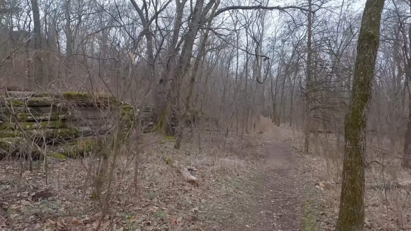
Tanyard Loop in Bella Vista is a delightful trail perfect for families and casual hikers. This 2.2-mile loop trail offers an easy and enjoyable hike through a picturesque setting. The trail is known for its accessibility and is a great option for those with pets, as dogs are allowed and can be off-leash in certain areas.
The highlight of Tanyard Loop is the Tanyard Creek Falls, a charming waterfall that creates a small, inviting swimming hole. It’s a popular spot, especially on weekends, but visiting on a weekday morning might offer a more peaceful experience.
It is well-marked and offers several branching paths for those who wish to explore further. Its scenic beauty and ease of access make Tanyard Loop a favorite among locals and visitors alike.
7. Bear Cave Trail
- Location: Morrilton, Arkansas
- Mileage: 1.1 miles (1.7 km)
- Main features: Unique rock formations, small caves, Native American rock art
Bear Cave Trail, located in Morrilton, Arkansas, is a short but fascinating hike. Spanning just 1.1 miles, this easy trail is accessible to hikers of all levels and is particularly appealing for its geological and historical features.
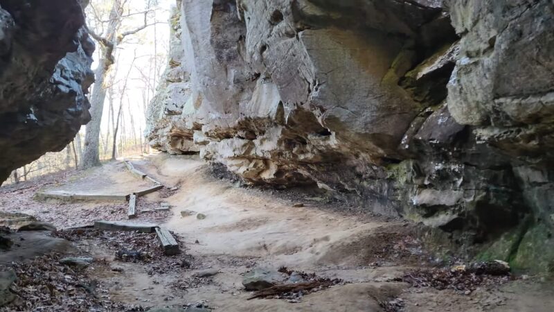
The trail is known for its massive rock formations and small caves that create a sense of adventure and exploration. One of the most intriguing aspects of Bear Cave Trail is the presence of Native American rock art, which offers a glimpse into the region’s rich cultural history.
The trail’s rock formations and overhangs, known as Bear Cave, are not only visually striking but also hold archaeological significance. Despite its ease, the trail does have sections with slippery rocks and exposed tree roots, so caution is advised. This trail is a perfect blend of natural beauty and historical intrigue.
6. Grand Promenade

- Location: Hot Springs, Arkansas
- Mileage: 0.7 miles (1.1 km)
- Main features: Historic Bathhouse Row, wheelchair accessible
The Grand Promenade in Hot Springs National Park is a beautifully paved trail that offers a leisurely and accessible outdoor experience. This 0.7-mile trail is perfect for those looking for a short, easy hike that is rich in history and scenery.
The trail is wheelchair accessible, making it ideal for visitors of all abilities. As you stroll along the Grand Promenade, you’ll pass by the historic Bathhouse Row, a collection of architecturally stunning bathhouses that are a testament to the area’s rich history as a spa town.
The trail is well-maintained and spacious, allowing for a comfortable walk. Along the way, informational markers provide insights into the history and significance of the hot springs and the surrounding buildings. This trail is a wonderful option for those who want to combine a gentle hike with a historical exploration of one of Arkansas’s most famous landmarks.
5. Lake Sylvia to Crystal Prong Creek via Ouichita Trail
- Location: Perryville, Arkansas
- Mileage: 20 miles (32.1 km)
- Main features: Solitude, diverse natural beauty, streams, and ponds
The Lake Sylvia to Crystal Prong Creek segment of the Ouichita Trail is a serene and picturesque hike through the Ouachita National Forest. This 20-mile trail segment is a haven for those seeking solitude and a deep connection with nature.
Its length and moderate difficulty make it a great choice for a multi-day backpacking trip. As you traverse this trail, you’ll be surrounded by the lush biodiversity of the Ouachita Forest. The path winds past streams, ponds, and rocky outcrops, all blanketed in rich vegetation.
The sound of running creek water accompanies parts of the trail, adding to the tranquil atmosphere. This hike is not just a physical walk but also an opportunity to experience the peacefulness and beauty of one of Arkansas’s most stunning natural areas.
4. Ponca Wilderness and Buffalo National River Loop
- Location: Jasper, Arkansas
- Mileage: 17.2 miles (27.6 km)
- Main features: Diverse scenery, route-finding challenge, hidden campsites
The Ponca Wilderness and Buffalo National River Loop is a trail that offers a diverse and immersive hiking experience. Located near Jasper, Arkansas, this 17.2-mile loop trail is a moderate challenge that combines lush forest scenery with spectacular views along the Buffalo River.
It is unique in its combination of environments. You’ll cross the Little Buffalo River, navigate through dense wilderness, and follow the Buffalo River Trail, which runs alongside the river. The trail offers bluff-lined river views before looping back into the forest.
This hike is not just about the distance; it’s about the variety of landscapes you’ll encounter, from riverside paths to wooded areas. It’s a perfect trail for those looking to experience the best of what the Buffalo National River and Ponca Wilderness have to offer.
3. Lake Fayetteville Paved Trail

- Location: Fayetteville, Arkansas
- Mileage: 5.5 miles (8.8 km)
- Main features: Easy lakeside urban hike, mountain views, connecting trails
Lake Fayetteville Paved Trail is a gem within the city of Fayetteville, offering an accessible and scenic outdoor experience. This 5.5-mile paved pathway encircles Lake Fayetteville, presenting an easy and enjoyable hike suitable for all ages and abilities.
The trail is particularly appealing for its flat terrain and beautiful views of the lake, wetland areas, and wooded hills. Benches along the trail provide spots to rest and enjoy the serene lake views. The trail also connects to other natural surface trails in the Lake Fayetteville Park system, offering options for those seeking a longer or more varied hike.
2. Athens-Big Fork Trail
- Location: Ouachita National Forest
- Mileage: 17.8 miles (28.6 km)
- Main features: Biodiversity, 500-year-old pine, scenic forest trek
The Athens-Big Fork Trail, stretching 17.8 miles one-way through the Ouachita National Forest, is a showcase of natural diversity and beauty. This trail, renowned for its well-maintained path, takes hikers through a mix of pine and hardwood forests, rich in vegetation and wildlife.
Small creek crossings and wooden bridges add charm and variety to the hike. One of the trail’s most notable features is The Big Tree, a majestic 500-year-old shortleaf pine, standing 52 feet tall. This ancient tree is a highlight for many hikers, symbolizing the enduring beauty of the Ouachita forest.
The trail’s length and moderate difficulty make it a fulfilling journey for those who appreciate long treks through diverse forest landscapes.
1. Lake Leatherwood Loop
- Location: Eureka Springs, Arkansas
- Mileage: 4 miles (6.4 km)
- Main features: Historic structures, lake views, geologic features
Lake Leatherwood Loop in Eureka Springs is a 4-mile trail that offers a unique blend of natural beauty and historical significance. This moderately challenging loop encircles the spring-fed Lake Leatherwood and is set within the picturesque Lake Leatherwood City Park.
As you hike, you’re greeted with dense forests, intriguing rock formations, and captivating geologic features like bluffs, caves, springs, and natural bridges. The trail’s route also takes you past historic structures dating back to the late 1800s, adding a layer of historical intrigue to your hike.
For those interested in more challenging terrain, there are connecting ledgy mountain bike trails. Lake Leatherwood Loop stands out for its spectacular scenery, rich history, and diverse terrain, making it a distinctive and rewarding hike in Arkansas.
FAQs
What is the hardest hike in Arkansas?
The Athens-Big Fork Trail in the Ouachita National Forest is considered one of the hardest hikes in Arkansas due to its challenging terrain and significant elevation changes.
What is a beautiful mountain range in Arkansas?
The Ozark Mountains are a beautiful and prominent mountain range in Arkansas, known for their stunning landscapes and outdoor recreational opportunities.
What is the largest waterfall in Arkansas?
Hemmed-In Hollow Falls, located in the Buffalo National River area, is the largest waterfall in Arkansas, with a drop of 209 feet.
How many hiking trails are in Arkansas?
Arkansas has more than 1,500 hiking trails, offering a wide range of scenic and diverse hiking experiences.
Closing Thoughts
Arkansas’s hiking trails offer an unparalleled opportunity to explore the state’s diverse natural landscapes. With their varying lengths, difficulties, and highlights, these trails cater to all preferences, ensuring that every hiker finds a path that resonates with their interests and abilities.
